
 United States
 United Kingdom
 Canada
 Australia
 New Zealand
 Ireland
Australia's expanding downpours face a southerly change past Alice Springs
WeatherWatchTV's Philip Duncan tracks eastern thunderstorm risks before cooler air pushes well beyond the southern coastline.
 WeatherWatchTV
Story of
Why this story? One of the most watched videos since yesterday, with 29,198 views.
 Oz: Downpours expanding, spring coolness in south
Things we can learn from the video
Press to jump
- 1:08Hot inland air contrasts with southerly winds keeping the southern coastline cooler.
- 1:55Maximum-temperature maps show inland parts of Western Australia and Queensland exceeding 40°C.
- 2:47The animated outlook tracks thunderstorm potential spreading east and south through Thursday.
- 6:27Duncan forecasts renewed weekend severe-weather risks across Queensland and coastal New South Wales.
- 7:18An early-next-week southerly pushes cooler air deep inland, extending beyond Alice Springs.
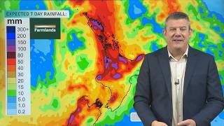
- 8:46The seven-day rainfall projection highlights heavier expected precipitation in eastern Australia.
Inland heat and cool coastal winds sit side by side in Philip Duncan's Australian outlook. Parts of Western Australia and Queensland are forecast to climb above 40°C, while the southern coastline stays much cooler. Then comes a southerly change with a surprisingly long reach.
The WeatherWatchTV forecast drew about 29,000 views since yesterday. Its subject is an unsettled stretch of spring: low-pressure systems drifting east from Western Australia and South Australia, spreading downpours and thunderstorms towards the eastern states.
Duncan follows the storm potential through Thursday, using pressure maps and broad severe-weather boxes to explain where conditions could come together. His weekend outlook brings renewed severe-weather risks to Queensland and coastal New South Wales. The final rainfall map puts the heavier projected totals in eastern Australia, though the storms shift from day to day.
The change of direction comes early next week. Duncan forecasts a strong southerly pushing cooler air into the interior, beyond Alice Springs, rather than merely brushing the southern coast. He expects it to clear rain and thunderstorms from some areas and reduce heat and humidity.
That distinction matters: cooler does not necessarily mean cold. Duncan explicitly softens his description of the inland wind as he traces its northward path. For viewers trying to picture how these systems connect across a continent, that map-by-map explanation is the substance of his "Big Picture" forecast.
Published on Trari
Where next?


 Is this your channel?For the channel's owners and team: a ready picture and text for your audience
Share the story with your audience. Everything is ready:
For an Instagram story or a WhatsApp status
For a community post or your channel's description
- Channel
- WeatherWatchTV
- Subscribers
- 146,000
- Channel views, last 7 days
- 515,254
- Channel views, pace per day
- 107,662 (on a normal day: 70,840)
- Video published
- November 10, 2026
- Video views so far
- 37,530 (less than a day online)
- Video views, pace per day
- 29,198
The numbers
The Australian outlook added about 29,000 views since yesterday. Its first-day comment section was also busier than usual for WeatherWatchTV.

💡 Test your knowledge
Which city is the capital of Western Australia?
Perth is Western Australia's capital, on the country's west coast.