
 United States
 United Kingdom
 Canada
 Australia
 New Zealand
 Ireland
New Zealand faces warmer days and hit-and-miss weekend downpours
Philip Duncan's forecast puts the upper North Island in focus for heavier rain, while eastern coastal areas look comparatively dry.
 WeatherWatchTV
Story of
Why this story? One of the most watched videos since yesterday, with 24,833 views.
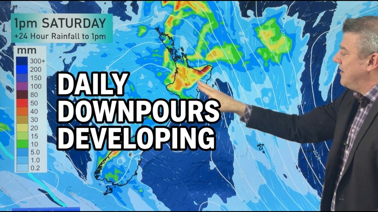 NZ: Daily Downpours coming, warmer weather too
Things we can learn from the video
Press to jump
- 3:03Low pressure strengthens over the Tasman Sea heading into Thursday.
- 4:01Thursday brings warmth, with Friday warmer still and temperatures potentially reaching 30°C.
- 4:19The approaching low weakens, but still brings a risk of downpours and thunderstorms.
- 5:31Saturday's heavier rainfall concentrates on the North Island, particularly the Bay of Plenty.
- 7:28Another sprawling Tasman low appears on Monday's map before Duncan reviews expected weekly rainfall.
Rain is heading towards New Zealand, but Philip Duncan's forecast makes an important distinction: a weakening Tasman Sea low could deliver local downpours without becoming a major storm.
In WeatherWatchTV's "NZ: Daily Downpours coming, warmer weather too", Duncan follows that low towards Friday and Saturday. The upper North Island and western and north-western parts of the South Island face downpours and isolated thunderstorms, with Saturday's maps putting particular emphasis on the Bay of Plenty.
The forecast drew about 25,000 views since yesterday. Unlike the broader November climate outlook we reported here, this is a day-by-day look at where the rain might land, and where it might miss.
Eastern areas from Hawke's Bay to Canterbury look among the driest, especially near the coast. Inland locations have a better chance of downpours. The description cautions that the rainfall maps may shift as the week develops because the heavier falls will be hit and miss.
Warmth is part of the picture too. Thursday's temperature map gives way to an even warmer Friday, with some places potentially reaching 30°C. By Sunday, Duncan shows polar air over south-eastern Australia while New Zealand remains in warmer northerly air, with afternoon showers.
For some viewers, rain is something to look forward to: comments ask for it in Ōpōtiki and Hawke's Bay, while another mentions thirsty plants. Duncan's closing assessment is similarly practical: "It is good news to get some of this rain in a number of areas."
Published on Trari
Where next?



 Is this your channel?For the channel's owners and team: a ready picture and text for your audience
Share the story with your audience. Everything is ready:
For an Instagram story or a WhatsApp status
For a community post or your channel's description
- Channel
- WeatherWatchTV
- Subscribers
- 146,000
- Channel views, last 7 days
- 499,077
- Channel views, pace per day
- 141,654 (on a normal day: 66,841)
- Video published
- November 2, 2026
- Video views so far
- 35,199 (2 days online)
- Video views, pace per day
- 24,825
The numbers
The forecast added about 25,000 views since yesterday. Here is how viewing and engagement stand.

💡 Test your knowledge
Which North Island region stands out for heavier rain on Saturday's forecast map?
Duncan's Saturday rainfall forecast puts particular emphasis on the Bay of Plenty.