
 United States
 United Kingdom
 Canada
 Australia
 New Zealand
 Ireland
What could pull Cyclone Xavier apart offshore
WeatherWatchTV's Philip Duncan explains why damaging winds could stay at sea even as the weakening storm brings rain to Pacific islands.
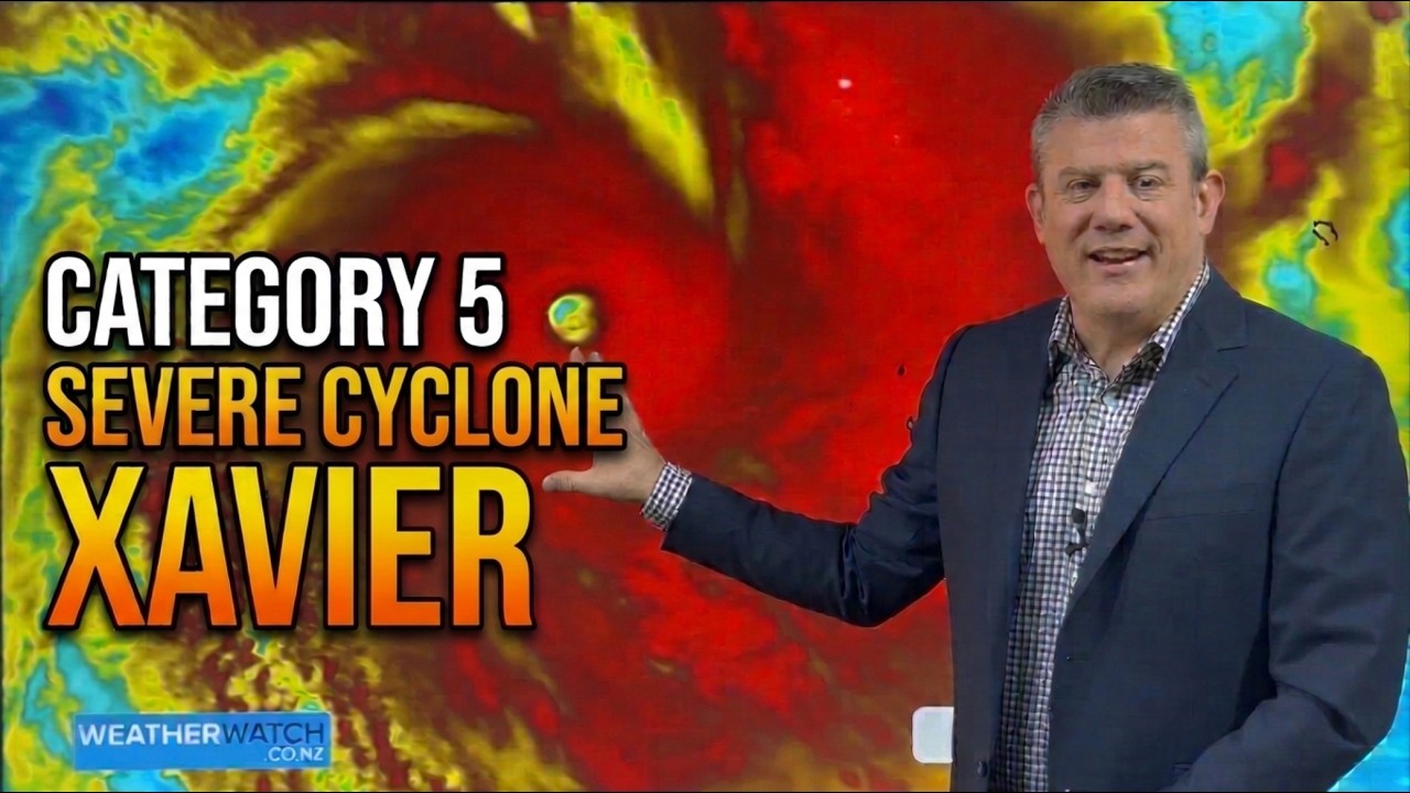 Cat 5 Severe Cyclone XAVIER
Up next



 WeatherWatchTV
Story of
Why this story? One of the most watched videos since yesterday, with 36,307 views.
Things we can learn from the video
Press to jump
- 0:04Xavier reaches Category 5 while nearly stationary offshore near the northern Cook Islands.
- 0:47Forecast tracks show Xavier moving slowly before weakening to Category 3 and below.
- 2:10South Pacific and U.S. cyclone scales average winds over different periods, so their categories don't map directly.
- 3:30Opposing trade winds and upper-level winds create shear that Duncan expects to disrupt Xavier's circulation.
- 4:58The wind projections keep the most damaging conditions largely offshore.
- 6:10Rainfall maps show why Niue and parts of the Cook Islands could still get heavy rain as Xavier weakens.
Cyclone Xavier had reached Category 5 but was barely moving. On WeatherWatchTV's maps, the storm was still out at sea near the northern Cook Islands. For forecaster Philip Duncan, the crucial question was whether it would weaken before its strongest winds reached populated islands.
In "Cat 5 Severe Cyclone XAVIER", Duncan puts the Fiji Meteorological Service's track alongside the one from the Joint Typhoon Warning Center. He also explains why the same storm can carry different ratings on different maps: the Australian and South Pacific scale uses winds averaged over ten minutes, while the U.S. Saffir-Simpson scale uses a one-minute average.
The clearest picture of what might weaken Xavier comes when Duncan switches to the wind maps. Near the surface, the trade winds blow one way; higher up, the jet stream blows the other. That difference is wind shear, and Duncan explains how it can pull the storm's circulation out of alignment. Several viewers singled out that explanation, with one pointing others to the map just before the five-minute mark.
The report drew about 36,000 views since yesterday. In a follow-up, WeatherWatchTV said Xavier had begun to weaken, though slowly. Rain was still in the outlook for Niue, and the channel said the remnants could carry heavy rain as far west as eastern Fiji.
A self-governing country of 15 islands in the South Pacific, in free association with New Zealand.
More on Wikipedia ›A self-governing coral island country in the South Pacific, in free association with New Zealand.
More on Wikipedia ›Published on Trari
Where next?
What do you think?
Want to know when somebody answers you?
 For the channel's owners and team
Share the story with your audience
A ready picture for an Instagram story or a WhatsApp status.
Ready text for a community post
- Channel
- WeatherWatchTV
- Subscribers
- 147,000 ▲ 1,000 this week
- Channel views, last 7 days
- 598,767
- Video published
- November 18, 2026
- Video views so far
- 146,602 (2 days online)
- Video views, pace per day
- 36,299 (on a normal day: 99,251)
The numbers
Here's how many views the Category 5 update added since yesterday, alongside its total since publication.

💡 Test your knowledge
What is the capital of the Cook Islands?
Avarua is the capital of the Cook Islands and sits on the island of Rarotonga.