
 United States
 United Kingdom
 Canada
 Australia
 New Zealand
 Ireland
Max Velocity's Northeast snow forecast hinges on a coastal handoff
His update draws nearly a million views as he separates confidence in an Arctic cold wave from much shakier snowfall predictions.
 Max Velocity - Severe Weather Center
Story of
No. 53 on the daily chartNo. 4 on the Science chart
Why this story? One of the most watched videos since yesterday, with 973,976 views.
 This Was NOT Supposed To Happen…
Things we can learn from the video
Press to jump
- 0:52An Ohio Valley storm could transfer its energy to a coastal system near the Mid-Atlantic.
- 4:05Forecast models disagree on the storm's track and potential snowfall in places including Albany.
- 5:21Precisely timed merging of atmospheric energy could determine whether a major nor'easter develops.
- 7:13Cooling within the storm could support snow, with higher elevations more likely to receive it.
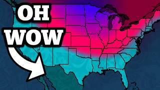
- 9:04Velocity gives the cold wave high confidence, but widespread snowfall low confidence.
- 10:14The regional outlook includes Pacific Northwest heavy rain and possible Great Lakes lake-effect snow.
Albany is one of the places where Max Velocity's snow forecast runs into a problem: the models disagree. A developing storm could become a significant nor'easter, he explains, or take a track that leaves much of the Northeast without widespread snow.
"Whatever the storm does, the cold is coming," the meteorologist says. That distinction anchors "This Was NOT Supposed To Happen…", which has drawn nearly a million views since yesterday.
The forecast follows a system developing over the Ohio Valley before handing off to a coastal storm near the Mid-Atlantic. The crucial question is whether separate pieces of atmospheric energy merge at the right moment, a process called phasing. Their timing affects whether the coastal system develops into a major nor'easter or heads out to sea. Strength alone will not decide who gets snow; the track matters too.
Velocity also explains why cold air arriving across the central and eastern United States does not automatically mean snow piling up everywhere. Cooling within the storm could help precipitation turn to snow, with higher elevations more likely to see it. By his summary, confidence in the cold wave is high, while confidence in widespread snowfall remains low.
This is a more immediate, location-specific question than the polar-vortex outlook we reported here earlier. Alongside the coastal uncertainty, Velocity flags heavy rain from an atmospheric river in the Pacific Northwest and potential lake-effect snow around the Great Lakes. His update offers a firm expectation of colder weather, but no settled snow total for Albany.
Published on Trari
Where next?


 Is this your channel?For the channel's owners and team: a ready picture and text for your audience
Share the story with your audience. Everything is ready:
For an Instagram story or a WhatsApp status
For a community post or your channel's description
- Subscribers
- 2,220,000
- Channel views, last 7 days
- 9,085,573
- Channel views, pace per day
- 1,404,161 (on a normal day: 1,179,882)
- Video published
- November 8, 2026
- Video views so far
- 973,976 (less than a day online)
- Video views, pace per day
- 1,185,831
The numbers
The forecast drew nearly a million views before its first full day was over. The figures below show its audience and response so far.

💡 Test your knowledge
An omega block gets its name from a weather pattern resembling which Greek letter?
The large-scale flow around an omega block resembles the uppercase Greek letter omega, Ω.